High Elevation Adventures in Bryce Canyon Country to Help You Beat the Heat This Summer
This article is sponsored by Bryce Canyon Country
Southern Utah means heat, right? Punishing, sweat-evaporating heat. Heat that banishes all but the most well-adapted critters into the shade or under the dirt. “Melt the thermometer” heat. “Clint Eastwood in a shootout at high noon” heat. Right?
Does an average high of just 80 degrees Fahrenheit in July fit your bill? How about nighttime temps that hover around 53 F the same time of year? With an average elevation of around 8,000 feet, Bryce Canyon National Park is an oasis of summertime comfort in a (literal) desert of high temps. You can hike, camp, bike and ride horses without feeling the full effect of the southern sun, free to be present in the moment instead of daydreaming of air conditioning and hotel pools. And if you get bored of Bryce, there’s plenty of fun ways to cool off and beat the heat in the surrounding region.
Balmy Bryce
Trips to Bryce Canyon National Park are often paired with visits to other iconic parks in Utah and Arizona, but Bryce Canyon’s weather is far different. Compare Bryce’s average July high (80 F) to places like Zion (100 F), Arches (100 F), Monument Valley (94 F) and the lower elevations inside the Grand Canyon (106 F), and you might just think about extending your time in hoodoo land.
As with any hike or adventure in southern Utah, you’ll want to bring plenty of water and sun protection before you head out. But on hikes in Bryce Canyon, you’ll experience what our Utah.com scientists refer to as “standard hiking discomfort” and not “sadistic heat torture discomfort.”
When exploring Bryce by foot, you don’t have to take the paths less traveled for a good time. The classics are the classics for a reason, and a trek into the maze-like (but well-marked) hoodoos of the Bryce Canyon Amphitheater via the Queens Garden Trail or Navajo Loop will be an experience you’ll never forget. And, of course, there’s nothing like a scenic stroll along the panoramic Rim Trail.
Hiking isn’t the only way to see Bryce. You can also ride your bike along the 5-mile shared-use path that travels from the visitor center to Sunrise, Sunset and Inspiration Points. The bike path continues down to scenic Red Canyon, 16 miles away, but features a 750-foot elevation gain on the way back that’s not for the faint of quads. You can also explore the Amphitheater by booking a horse ride that travels along dedicated horse trails and the Peekaboo Loop.
Do Go Chasing Waterfalls
Not everywhere in Bryce Canyon Country is blessed with high elevation balminess, but there are still plenty of ways to keep a cool head. One of the best methods? Literally dunking your head under a waterfall.
Two of the most popular waterfalls in the region are Upper and Lower Calf Creek Falls, located in Grand Staircase-Escalante National Monument. Lower Calf Creek Falls can be reached by a 6-mile out-and-back trail, which earns a moderate rating only due to exposed conditions and some sections in deep sand. The hike itself is beautiful, with pictograph panels, interpretive signs and viewpoints along the way.
At the falls, you’ll find a deep swimming hole to splash around in and cool off. Although the refreshment factor is at its highest when the sun is hottest, you’re best off setting out in the morning. By the time you arrive, temps will be warm enough for the cool water to work its magic, and you’ll be happy to only have half of your hike in the midday sun.
For a shorter hike and a less crowded locale, head to Upper Calf Creek Falls. The trailhead and waterfall are a bit harder to find, and the main trail leads you to the top of the falls rather than the bottom. But there are several pools to swim in and an oasis of desert greenery that’s good for the soul. The Upper Falls hike features steeper slickrock terrain that some might find challenging, but others might prefer it to the sandier stepping of the Lower Falls.
Summer in the Slots
Move over Vegas — the best slots in the Southwest are a few hours to the east. Bryce Canyon Country is home to some of the most stunning slot canyons in the Southwest, and some of them even give you a chance to cool off while you trek.
The 6.6-mile Zebra and Tunnel Canyon loop is one such hike. Neither slot is very long, but both are known to feature water, often waist-high or higher. Zebra Canyon is narrow, moderately technical and endlessly photogenic, while Tunnel Canyon lives up to its name with total shade and icy water that’s rarely below the waist. The hike in and out are exposed, so start in the morning and savor the coolness when you can.
Another slot that’s cool in the summertime is Willis Creek Canyon, located about 40 minutes from Bryce Canyon. Willis Creek is a wide, shady trail along a small stream with all the geologic twists and turns of a slot canyon, but none of the gut-sucking or scrambling you’ll find on narrower and more technical treks. It’s rated as a moderate hike due to its elevation gain.
Speaking of weather, be sure to check the forecast when hiking any slot canyon, technical or not. From mid-June through September, hikers should keep a vigilant eye out for monsoons and subsequent flash floods. With tight spaces and no easy escapes, slots are one of the most dangerous places to get caught in a southern storm. Never hike alone, never hike on rainy days and study up on flash flood safety.
Fishing for Cooler Temps
Maybe you’re more of the “If it ain’t broke, don’t fix it” kind of summer adventurer. In that case, you’ll find no better way to cool off than by setting up your camp chair or wading into the water to cast a line. The diverse fisheries, scenic backdrops and cool temperatures of Bryce Canyon Country all add up to a world-class fishing experience that’s hard to beat.
Panguitch Lake is one of the most popular fishing lakes in the area, and it sits at a similar elevation to Bryce Canyon. The area’s cool climate is enhanced by the breeze off the gentle water, but that’s not all the water’s good for. It’s chock-full of trophy-size rainbow, cutthroat and tiger trout. In fact, the name “Panguitch” comes from the Paiute word for “big fish,” and it’s not uncommon to pull out a trout over 20 inches.
Another high-altitude hideout for some of the state’s finest fish is the Boulder Mountain area. Also known as the Aquarius Plateau, this area is paradise for fishing enthusiasts (and you don’t even need to be a water sign). Ranging from 10,000 to 11,000 feet in elevation, Boulder Mountain is home to more than 80 alpine lakes (and plenty of creeks), most of which are teeming with trout. Looking for a sure thing? Head to Blind Lake. The largest lake on Boulder Mountain, it’s home to large-catch trout and one heck of a view.
Fishing licenses are necessary for all outings and can be purchased online or at local outfitters. You’ll be steaming mad about the fine you’ll receive without one, and that’ll undo all that hard-earned cooling off. Better not chance it.
AC While You Sightsee
If it’s too hot to leave the car, don’t sweat it. Many of Bryce Canyon Country’s most scenic spots are easily viewed from the road. Not only is the area home to Scenic Byway 12, one of the most scenic roads in the country, but there are also countless byways and backways to explore, with lookouts and side hikes galore.
Let’s start with the headliner — Scenic Byway 12. Also known as Highway 12, it was rated one of the top ten scenic drives in the country by Car and Driver magazine. Some very unofficial math places the 122 miles of Highway 12 in the top 0.0003% of roads in America. That’s rare company.
Sights along Highway 12 include Bryce Canyon National Park, Grand Staircase-Escalante National Monument, Escalante Petrified Forest State Park, Kodachrome Basin State Park, and countless other unnamed geologic features, with a finish just outside of Capitol Reef National Park. This is some of the most ruggedly beautiful terrain accessible to the everyday driver in all of America, with red-rock cliffs, high-desert forests, towering mountains and slickrock canyons on full display.
As you travel along a genuine All-American Road (one of only 37), consider breaking off on one of the nearby scenic backways, like Hole-in-the-Rock Road, the Burr Trail or Hell’s Backbone. What’s the difference between a byway and a backway, anyway? Backways are usually unpaved and travel through more rugged areas, with lots of opportunities for hikes and other adventures.
If you can only drive one, make it the Burr Trail. Although Highway 12 ends at the doorstep of Capitol Reef, you can enter the far reaches of the park earlier by taking the Burr Trail from the town of Boulder. You’ll travel past Navajo sandstone dunes, imposing cliffs, stunning vistas and the unique rises and falls of the Waterpocket Fold, Capitol Reef’s geologic claim to fame.
If you’re trying to stay cool, you don’t need to leave Utah for summer vacation. In fact, going south might be the key to some totally temperate travels. Start planning your trip to Bryce Canyon Country today, and you might just save some money on that AC bill come summer.
Categories:
Destinations:
You May Also Like
View All11 Iconic Hikes in Utah
Want to walk all over a celebrity? From Angels Landing to King’s Peak, these are the best hikes in U...
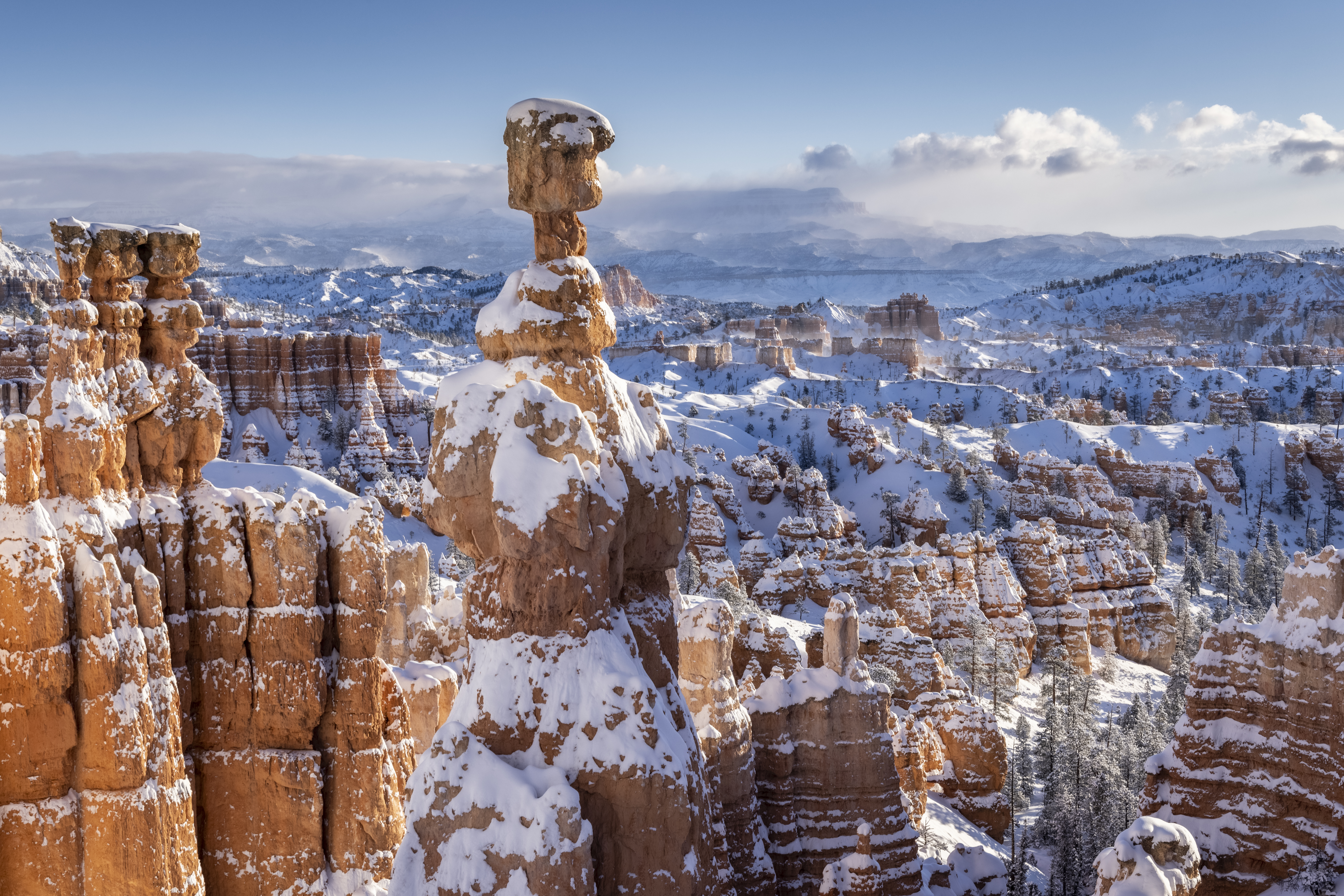
Bryce Canyon in Winter: 5 Things to Do in Hoodoo-ville
Bryce Canyon Country is a spectacular place to go when it snows. Start planning your getaway to this...